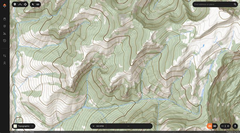


Our custom topo map on the web allows you to discover hidden hunting areas when e-scouting.

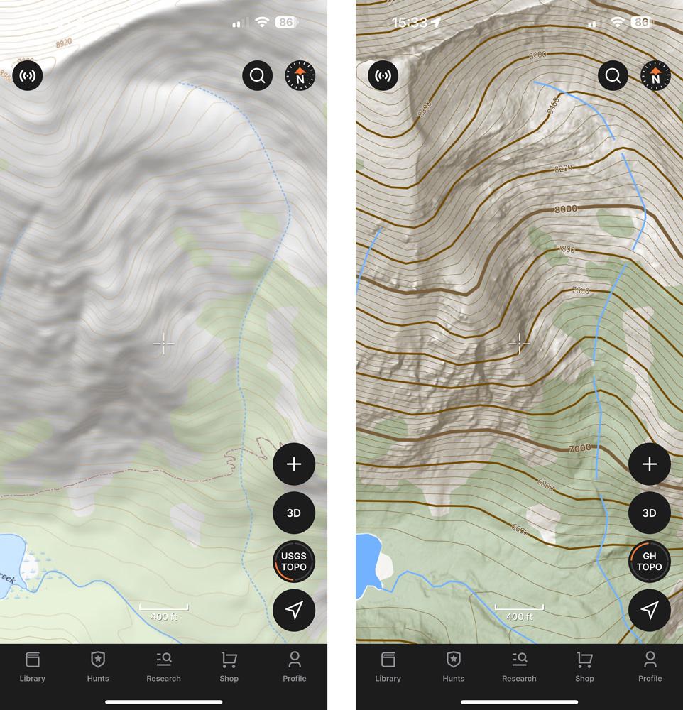
USGS topographical map on the left vs. the custom GOHUNT topographical map on the right.
When you're e-scouting and planning out your upcoming hunts, don't forget that our custom topographical map is also available on the web and the GOHUNT mobile app! You’ll be able to use our topographical map in both 3D and 2D!
We designed this topographical map based on the needs of hunters. This isn’t a standard topo map from decades ago, this is truly a better topographical map experience.
Sign up for GOHUNT today and experience a better topo map!
We put a lot of time and effort into creating a topographical map that hunters need and will greatly benefit from during e-scouting and while hunting in the field. Also, this topo map gives you a very clean view that is easy to see terrain details on. Our goal was to remove all the noise and give you added details when hunting.
With our custom topographical map, you’ll instantly notice every detail of your hunt area. To get more detail, we have incorporated custom hill shading in the map. This custom shading helps you easily see the relief and details of mountainous areas, providing you with a hyper-detailed map of the ground floor while keeping a very clean map view.
When using topo in the field, you’ll easily be able to see trails, water sources, saddles, pinch points, places to glass, and much more at a higher level of detail. Everything you need to gain an edge when trying to identify animal movement.
You will also notice different contour line styling, designed to easily see contour index and contour interval lines. This is beneficial when planning a route through some tricky terrain.
We've also made the vegetation layer a little darker to help hunters orient themselves to open country, timber, and edge habitat at just a glance.
At the end of the day, a topographical map is critical when e-scouting and on a hunt. If you want to learn more about how to read a topographical map, check out this article here.
We set out to build the best topographical map for hunters while keeping important details clean and easy to see. Check out our topographical map today on the web version of GOHUNT Maps and on our mobile app.
What if a hunter built a topographical map? Well… now you get to experience the benefit yourself!
Check out the Big Hunt Guys Podcast episode below to hear the guys talk about our custom GOHUNT topographical map:
Also, check out the video below to watch Brandon Evans dive into his favorite features of our topographical map:
If you have our GOHUNT mobile app already, update your app and download maps before you head out in the field to get the best topographical map.