How to access this information when researching tag opportunities and for your upcoming hunts. Start using this wildfire/burn data to your advantage

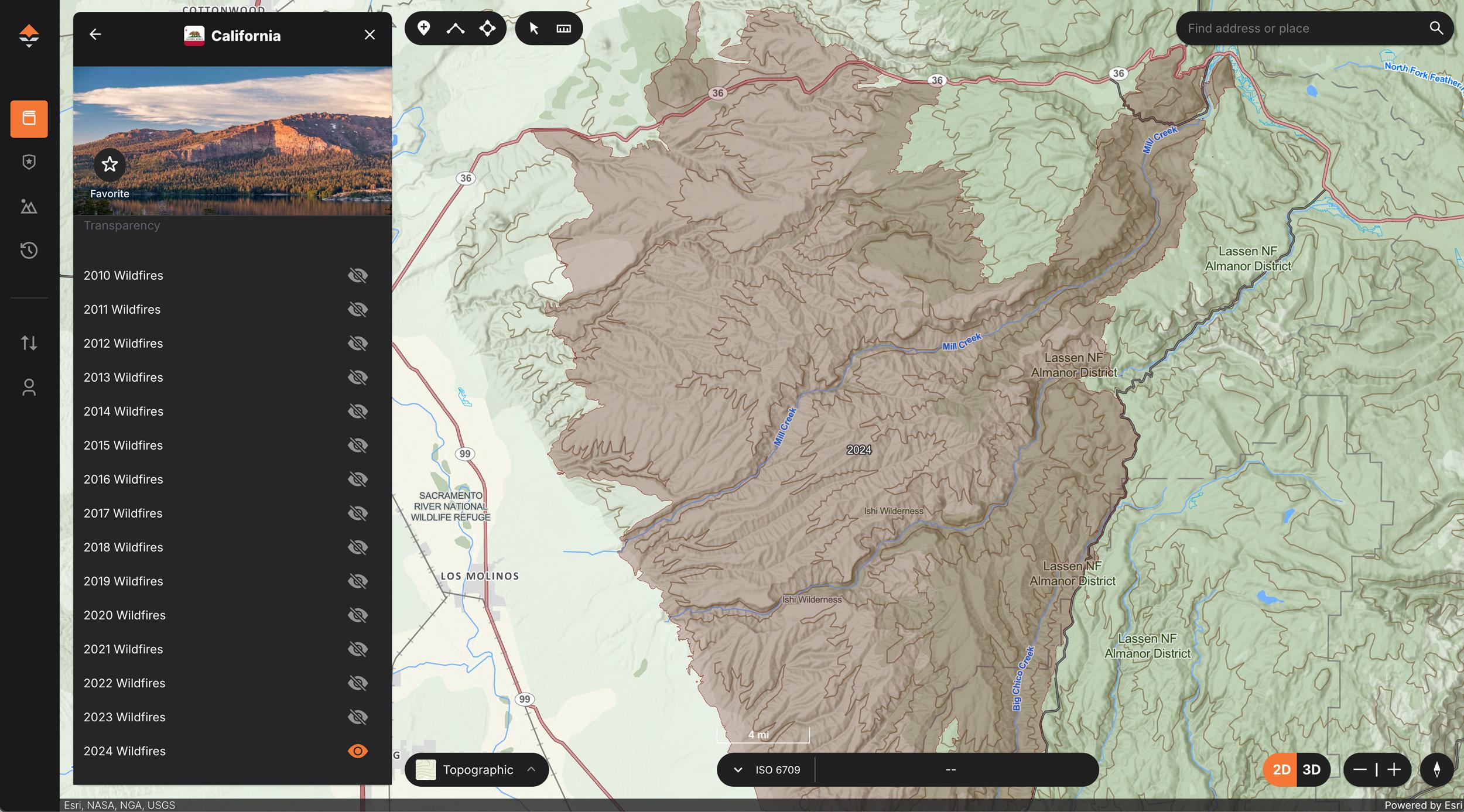
Accessing wildfire layers on the web is as simple as jumping into a state, tapping on Wildfires, and then clicking a combination of years.
Navigate the state layers, select "Wildfires," then select the year you're interested in.
While hunters are never really out of application season, as there are always tag opportunities to research, the hunting season will be here before we know it, and that means it’s also time to start diving into maps. Using maps while researching for hunts is a great tactic, and it’s never too early to start doing your mapping research once you have a tag already in your pocket.
When trying to find your next hunting opportunity or researching for an upcoming hunt, don't forget that we have Nationwide Wildfire Layers on GOHUNT Maps on the web and on our mobile app. This information can aid in your mapping research this fall and even down the road as these wildfire burns age.
Accessing our Wildfire layer is super easy on both our mobile app and on the web. Below I'll walk through a quick example of how to find this information on our mobile app.
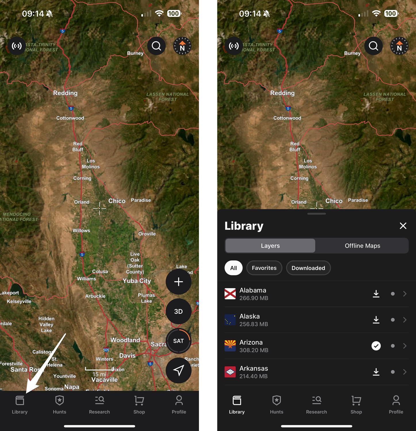
Open the GOHUNT app and select Library. The Library drawer will open. Next, select the state you're interested in.
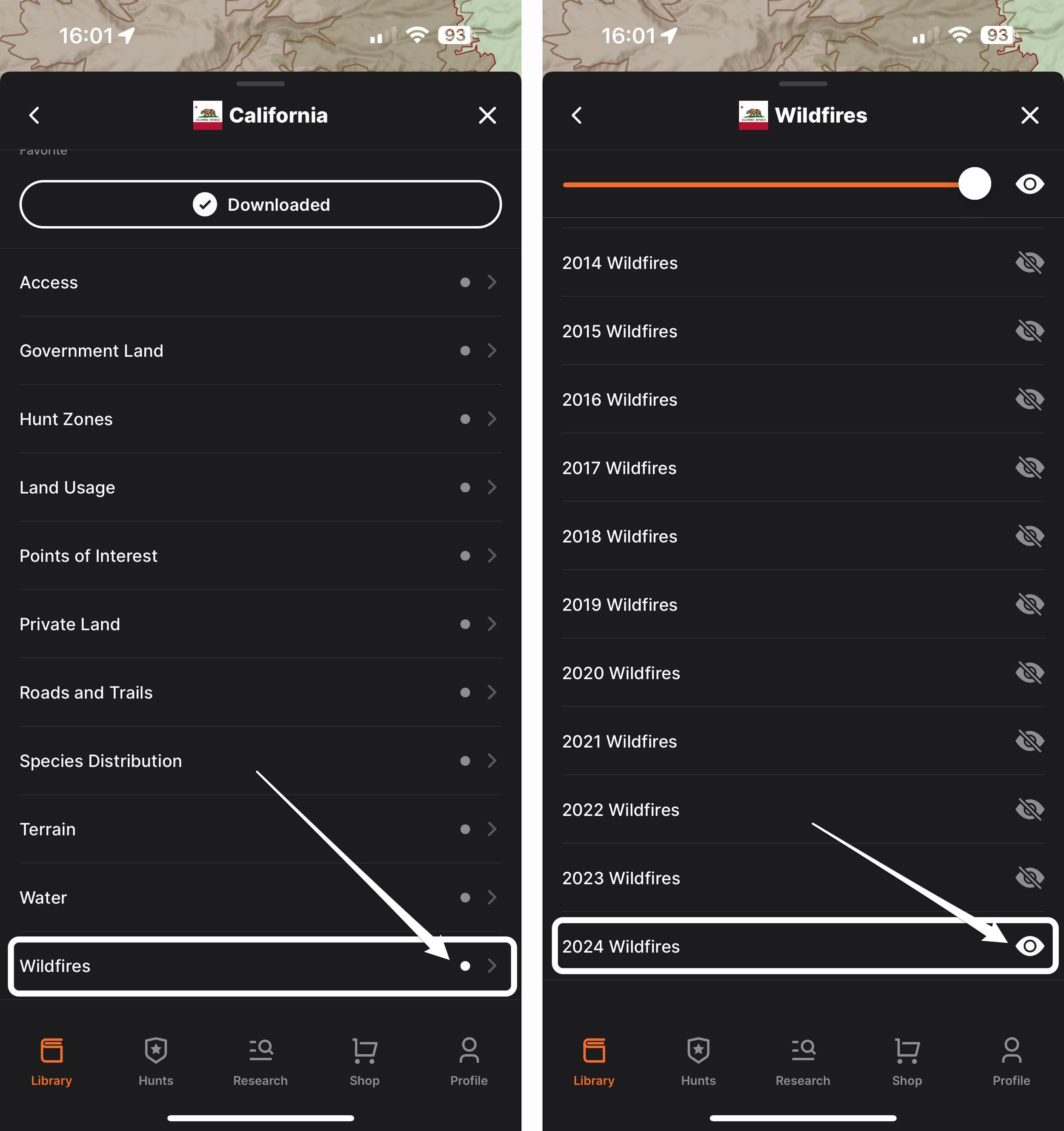
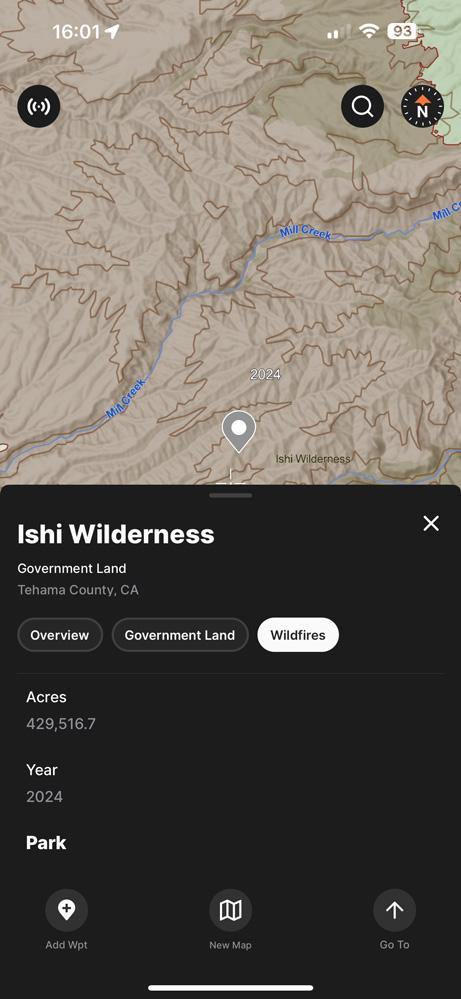
Scroll down the bottom of the layers, and you'll see "Wildfires." Tap that, and a new section will open showing wildfire layers broken out by year. Select any combination of years, in this case, 2024, and then typically, I'll adjust the layer transparency at the top.
Tip: when looking at wildfire layers in the mobile app or on the web, you can tap on the wildfire layer and then select the "Wildfires" tab, and it will give you information about the wildfire, like the name, year, and acres burned.
Looking at wildfires in a hunting unit is a great strategy! As burns age, they become productive for animals. Using these Wildfire layers on GOHUNT in conjunction with our Historical Imagery tool is one of my favorite methods for in-depth burn e-scouting.
I highly suggest you check out the article below. It will dive into my method for using the Wildfire layer and Historical Imagery and offer some suggestions on when to hunt a burn.
We also have a way to see real-time active wildfires on the web version of GOHUNT Maps. Check out that article below:
Insider makes it easy to find tag opportunities by state, species, probability of draw odds success, and much more! Whether you have 0 points, max points, or any number of points for specific states, Insider gives you the information you need to plan a successful hunt. In addition to our research tools, all Insiders have access to GOHUNT Maps on the web and mobile app. We know that not everyone has access to their computer when they want to research for a hunt, so our research tools are also available on our mobile app. We have the only complete set of research/hunting tools to help you find the hunt you want this year or to help you plan for hunts in the future.
If you're unfamiliar with Insider, you can learn more below.