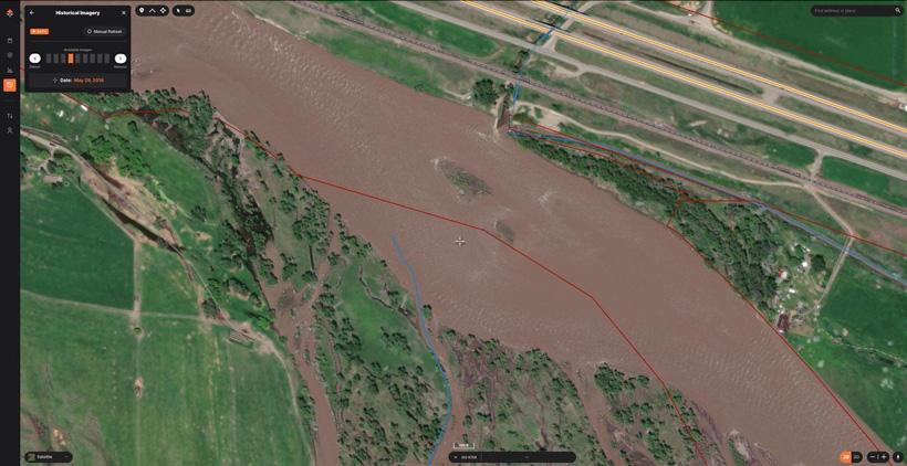


High water on May imagery.


Summer scouting is in full swing. We have had a stellar year for moisture in my part of Montana and, from what I can tell, the antler growth reflects that. With a good snow year and wet spring, it’s looking like everything will stay green well into July and the rivers will continue to be blown out. Makes for tougher fishing now, but it will all be worth it later in the summer and fall.
With our recent launch of Historical Imagery, we are going down the rabbit hole on as many different use cases this feature provides as we can. This time around I’m going to share how I use Historical Imagery to scout rivers and streams. I share what I look for and why. This is not only useful for the fall hunts, but if you’re a fly fisherman like myself, this tool is awesome for planning your fishing trips too.
If you have spent any time on rivers across the West, you know that May and June is the time they blow out. The combination of the winter snowpack melting plus the spring rain and warmer temperatures swell the rivers with chocolate milk-covered water that can make accessing the river flat-out dangerous until the flows go down. I’m blessed to live in Montana where we have the best high-water access laws anywhere. Mix that with land-locked public land that is only accessible by boat and you have a recipe for some great hunting. This fall, I will be doing a float hunt out of my raft looking for whitetail deer. With the rivers high, now is not the time to float and scout. However, with Historical Imagery, I can get a good idea of what the river will look like in the fall and start to make a plan.
High water on May imagery.
Although high water would be the most fun time to hit the river and find some white water, it’s terrible for everything else. Like anything weather-related, high water even when it goes back to normal changes every year. However, using Historical Imagery, you can still get a good idea of when the water typically starts to go down and build your boots-on-the-ground scouting plan around that time.
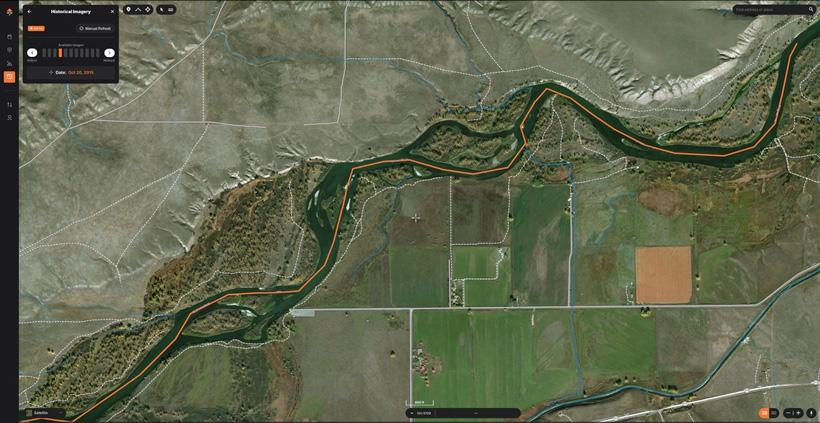
Navigating a river can be tough. If you’re floating a river that is new to you it is always a good idea to take someone with you that has rowed that river before or tag along with someone on their boat. Rivers are always changing, which means having knowledge of potential obstacles ahead of time can make your day a hell of a lot easier. This isn’t always possible and that’s where Historical Imagery comes in. On my maps, I look at the river I’m going to float and turn on Historical Imagery. I then cycle through the dates until I find one that is close to the date I will be there. On a river like the one below that’s loaded with shallow “back-channels,” this will show me where I can float to avoid getting stuck. Then, I’ll “Draw a Line” marking the route I want to take on the river. Once I am on the water, all I need to do if I’m not sure which way to go is pull out my app, check my line, then decide if what I e-scouted matches what I’m seeing in real time.
Historical imagery is a good starting point for figuring out water levels and flows. Rivers are measured in “CFS” or cubic feet per second and, with a quick Google search, you can find the CFS for nearly any river. Safe, floatable water is different on every river since they come in all shapes and sizes. With a little digging, you can figure out what the normal CFS is on your river. Combine that with Historical Imagery and you can dial in your route pretty quickly.
Fortunately, by the time the fall hunting season rolls around, rivers are not so temperamental and, in some cases, are not floatable at all due to lack of water. So, in general, it is a very safe time to be on the water. However, when floating in the fall in states like Montana, it’s important to always factor in the weather and plan accordingly. Here are a few things I’m using Historical Imagery for when looking for places to hunt out of my raft.
A note: As I identify these, I save color coded waypoints and make sure to take notes on why I saved that location.
The fact that a river can — and does — change cannot be overstated. That is why Historical Imagery is such a powerful tool for rivers. With several years of satellite imagery, you can get a very good idea of what to expect on the water.
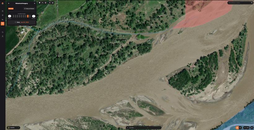
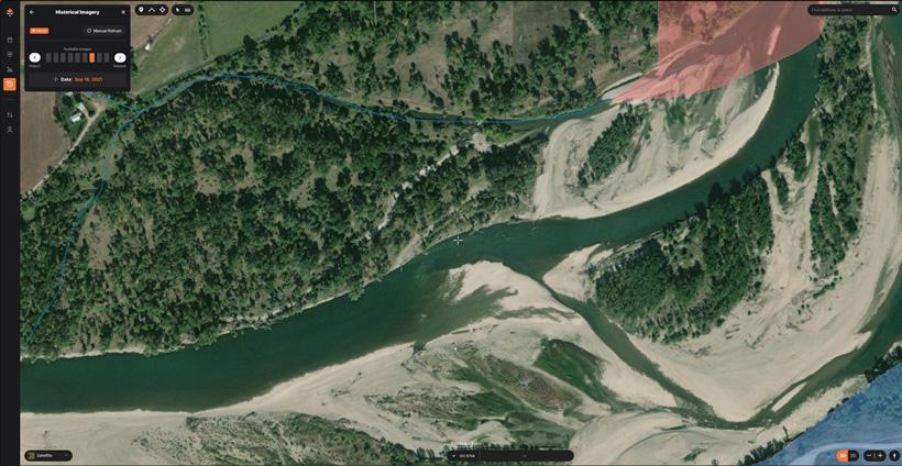
The image above and below are of the exact same spot at different times of the year.
If you only went off of the first image, you would have no idea what to expect come fall and you may completely overlook this location in your scouting since it looks like the river is so wide. This also shows why you need to use imagery from the time you will be hunting. If you used the first image, you might draw a line on a route that will be dried up come fall.
If you read my article about using Historical Imagery for snow, then you know that one of my primary objectives while hunting is to get away from other hunters. The same goes here. The whole point of getting on the river is to find the honey holes that no one else can — or won’t — put in the work to get to. Rivers are very dangerous and nobody should be floating them and hunting them without prior experience. Just like hunting the mountains, it’s easy to become a statistic if you don’t know what you’re doing. As long as you take your time, plan properly with tools like Historical Imagery and have fun, hunting the river can be the best hunt of the year.
If you’re not familiar with GOHUNT, check out the link below to learn more about everything we cover to make your e-scouting and hunting efforts more successful. You can find everything you need to have the best season ever with a GOHUNT membership. You can also check out our maps and research tools on a 7-day free trial.
Floatable water
Landlocked public land
Cover (trees and shrubbery) below the high water mark
Camp spots
Distance between boat ramp locations