

Source: Screenshot from GOHUNT Maps

Source: Screenshot from GOHUNT Maps

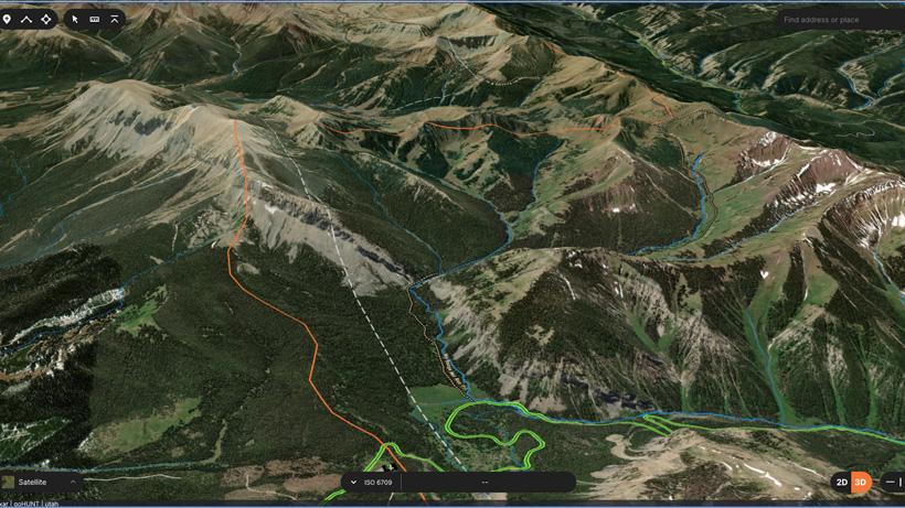
In a recent article, I covered some of my strategies for e-scouting archery elk using GOHUNT Maps. That article was largely centered around using the web app to effectively pick an area apart and, hopefully, get you on to the elk faster. In this article, we will be focusing on using the information we mark on web maps to efficiently plan a scouting trip into elk country to ground check our suspicions.
Because I travel so much to hunt anymore, most of my scouting trips are out of state and away from home. Because of this, efficiency in time is very important and I like to have a solid game plan in place prior to heading out. With any scouting trip, I like to be laser-focused on the types of signs I am trying to find and will try to list out my primary goals prior to leaving.
When it comes to archery elk I am almost always looking for the same things on a scouting trip.
One of my primary goals for any scouting trip is to assess access options in the area and get an overall judge on the lay of the land. Oftentimes, things look much different on a computer map than they do in real life. Because of this, I'll often find that ground checking an area can actually clue me on on different access points into given locations. Additionally, learning which roads are and are not open can really help in the long run and save me on a two hour hike in the dark on opening morning only to meet a guy on his four-wheeler sipping coffee and waiting on daylight.
Another thing I really like to look for is water and potential wallows. Water is king, obviously, and is a big factor in any elk habitat. For this, I really like to look for running water sources, or water sources I don’t think will dry up by the time season has arrived. With the water, I’m not necessarily looking for anything specific, more so just confirming that the area does have reliable water. One thing to keep in mind while scouting is that most wallows will not be active this time of the year, but past wallowing activity will still be apparent. If I find any areas that look like wallows, I will drop a waypoint on them and then check them again come the fall hunting season.
If I have a trail camera with me, I will usually try to find an obvious wallow location to put it on.
Rubs are another thing I really like to look for. Rubs can be somewhat easy to age for the first years after they are fresh. With these, I can see historical rutting activity in a given area and gauge year to year activity with some discretion. One thing to keep in mind here, from my experience rubs can generally be found in two locations in the high country, pre-rut staging areas, and actual rutting areas. Typically, the pre-rut staging areas will be where bachelor groups of bulls are stripping their velvet prior to moving into rutting areas. Generally, if I am seeing the rubs in close proximity to trails, old scat, or wallows I can delinieate that the area was likely used by an elk herd and not just a few bulls. With rubs, I try to take them with a grain of salt and really just use them as a confirmation of the presence of elk.
Trails are another thing I really like to look for, for obvious reasons. Often times trails won’t have fresh tracks on them at this time of the year but I can certainly pick out trails with historical use on them. One thing I've found in a lot of the areas I’ve hunted elk is that trails will be common and encountered all over but there are particular trails that elk tend to use over and over. These are the types I am interested in finding and they can usually be located in prominent areas like major ridgelines, big saddles, and coming to and from wallows or water sources.Sitting over wallows and trails are among my favorite mid-day uses of time when in the elk woods. Having some of these likely travel corridors picked out before actually hunting can be hugely advantageous.
If this area has some solid glassing points and glassable areas, I will try to also hit these while scouting in an effort to validate them as worth at the hike once season starts.
Along with the pieces of sign I am looking for there are also factors I'm not necessarily concerned with.
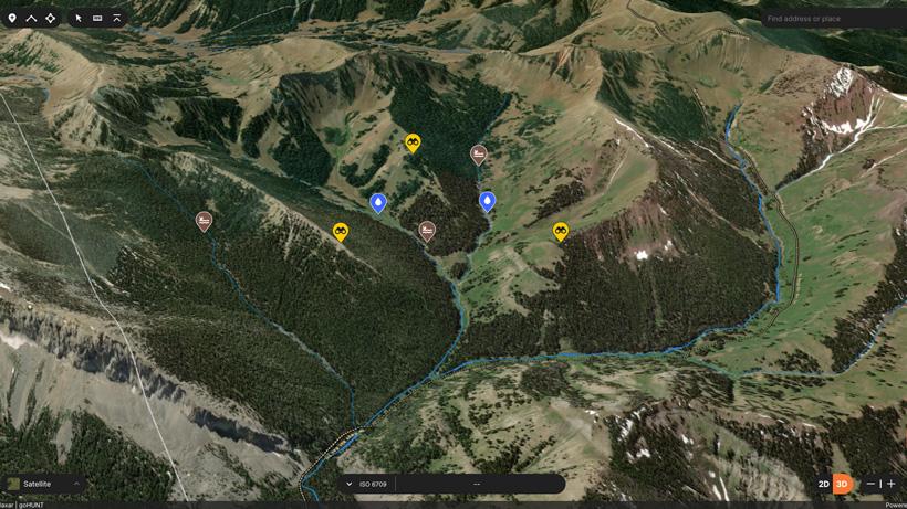
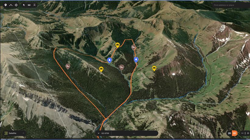
With some basic understanding of what I am looking for, I can start dropping pins on my map where I expect to find some of the sign types I am hoping to find and my planned route through the area to hopefully validate my suspicions.
Source: Screenshot from GOHUNT Maps
This example area has what appears to be good water running out of a few major drainages. There are some pretty green patches up high so I’m expecting this area to have some decent water. With the amount of water here, I am really going to be checking hard for wallows. Wallows are where you find them, but in general I like to just think about how the water would flow off the mountain. It’s going to pool in flat areas and these can always be good spots to check. That being said, a simple spring on the middle of the slope can be blown into a wallow just as easily. You won’t find all of the wallows but putting yourself in likely spots should turn up some positive signs.This area has some exceptional glassing options and this would definitely be part of my hunting plan for this spot. These three glassing points should give me a good view of most of this basin but I will need to personally check these to verify that.
Past a few waypoints, I also like to plan a rough route I’ll take through this area to check for sign. I won't be concerned with really covering the whole area, but just enough to confirm that elk do use the area. With this planned route I will be able to double check some water sources, confirm some glassing points, and move through some dark timber checking for trails and potential bedding or rutting areas.
With my travel routes mapped out and my points of interest marked there's nothing left now but to download offline maps for my GOHUNT Maps App and head out. With my mobile app, I’ll now be able to check all of the waypoints we marked on the web in real-time and can bring back all of my newly created content to the desktop app once I return.
Seeing elk/hearing elk - Typically most elk will not be moved into their primary rutting grounds until late august/early September. Often times I am scouting in June and July and encountering elk in these areas during this time is not common.
Scat - Again, elk aren’t typically in these areas during this time and scat is extremely hard to age.
Bedding areas - If I see something that looks like a definitive bedding area, I’ll investigate and mark it on my map but in general, without fresh sign, these areas can be hard to confirm.