


A topographic map, which is also sometimes referred to as an elevation map, is simply a detailed two-dimensional representation of the Earth's surface shown as a series of contour lines with each line delineating a different elevation. The association of elevation with the contour lines allows the reader to interpret the three-dimensional lay and vertical scale of the land. In short: you can use a topographic map to quickly see where the hills, rivers, peaks, and valleys are. When you are navigating, a topographic map can show you where you are and help you know what route you should take.
Contour lines show elevation change on a topographic map and are used to measure the steepness/grade of terrain. Contour lines also display terrain features. Understanding some rules of contour lines can help you become efficient at scouting topo maps and provide knowledge on how an animal may traverse through a landscape.
A valley is a low area of land between hills or mountains, typically with a river or stream flowing through it. Typically, it has a broader bottom than a canyon.
A canyon is a deep, narrow valley with steep sides, often with a stream, creek or river flowing through it.
Drainage is often used similarly to a valley or canyon. A drainage is an area of land where water from rain and snow melt drains downhill. A drainage basin is interchangeable with a watershed, which is the entire area where the surface water runs downhill into a body of surface water. Drainage seems to have a broader connotation, i.e., there may be several smaller valleys/canyons/draws within the drainage basin.
A draw is a low area between hills or mountains. The difference between these and others is that a draw trends perpendicular to the ridgeline. Also, the use of the word draw seems to have a lesser connotation to canyon or valley. It tends to be smaller in size and steepness.
Most commonly used in the southwest. An arroyo is small- to medium-sized and steep-sided and holds ephemeral streams. It is usually dry except after heavy rains.
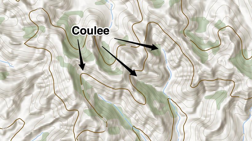
A coulee is a term applied rather loosely to different landforms — all of which refer to a kind of small- to medium-sized valley that is typically dry or intermittently has water flowing during sizable rainy weather. It is most commonly used throughout the midwestern and even some western states.
A basin is a landform where an area of the earth dips on all sides towards the center. It looks like a bowl made out of the earth. It is most often used when someone is referring to a large dished-out area at the upper end of a canyon. “That canyon opens up into a large basin that can be good for finding bucks on the summer range.” The look of a bowl or basin can be spotted by looking for steep and circular contour lines.
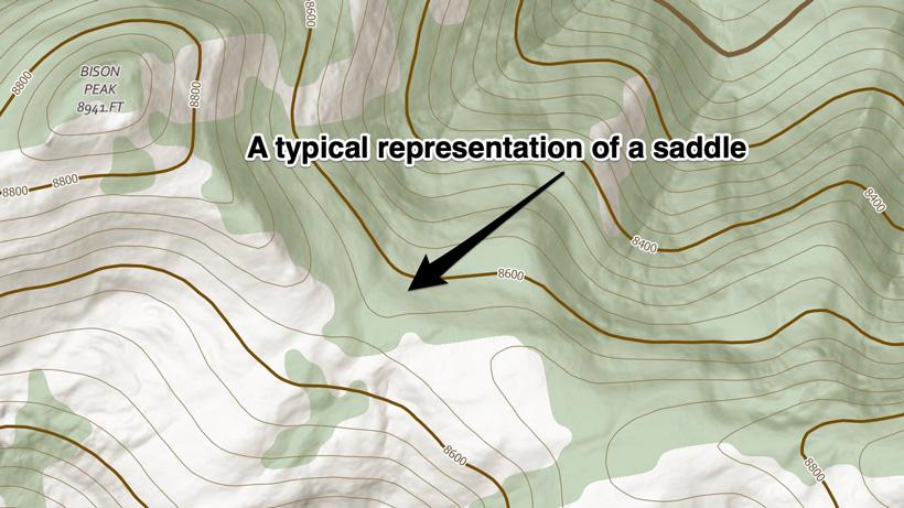
A saddle is literally that shape in the mountain that is high and broad at each end and narrower and lower in the middle. The saddle typically connects two mountains (or peaks). Think of it as the best transition point from one canyon over into another one. On a map, contour lines will form an hourglass shape with rising contour lines on each side. Like people, big game animals naturally prefer traveling on the path of least resistance. When a low spot in a ridge or hill is present, it provides an easier way to cross. Saddles are great escape routes from one canyon into another. They also serve as natural travel and sometimes bedding sources for animals and can be good options for ambush hunting.
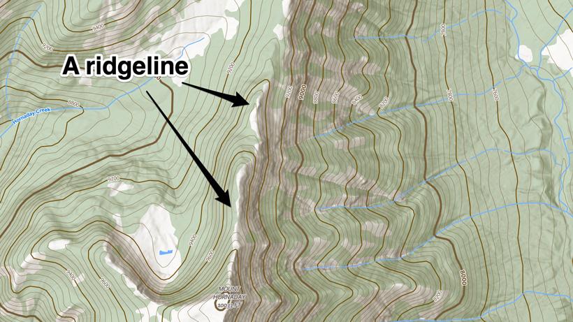
A ridgeline is a long, narrow, elevated feature that typically connects mountain peaks. The topography slopes down away from the ridgeline on both sides. Ridgelines or ridges are great travel routes for big game animals. Typically, big game will not travel directly on top of a ridge to avoid being “skylined” and easily detected, but will mostly travel in the top third of the terrain on either side of the ridgeline. On a topographic map, a ridgeline will look like a long consistent stack of lines running in the same manner. Ridgelines are good for navigation and covering the country, often being more flat on top. They are also good bedding areas for deer and elk. Elk seem to prefer them during late seasons when they can see and are in close proximity to canyons where they can escape.
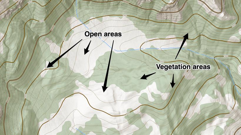
Solid green means that the area is mostly covered by tall vegetation AKA forest. White at the top of contour lines means an alpine zone where the trees have stopped. White in a flat area means a lack of tall vegetation, which could be grass, dirt, desert, etc. Looking at the elevations on a topo map and location will give the green areas context as to what type of vegetation may be in any given area.
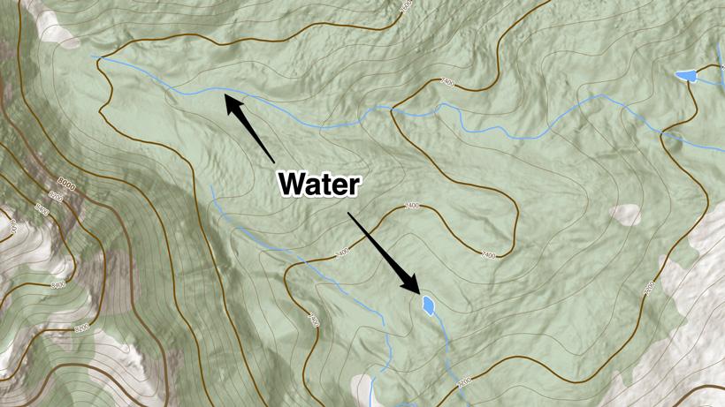
Blue features are usually water. Standard contour lines are brown.
Bedding preference is one of the first considerations. Big game typically spend the majority of their day bedded since they primarily feed just after light and just prior to dark. Feed and water are critical as well. In addition, escape and travel routes are also worth considering. If you understand where game prefers to bed, feed, water, and where they are likely to escape or travel to, you have what you need to successfully find game. Generally, the better the habitat is and the less hunting pressure there is, then the more game you will find. Not all areas will have habitat that meets the needs of the animal. Some areas will receive more hunting pressure and move animals into secondary range. Being able to identify features on a map is the key to finding and hunting big game.
Elk, mule deer and other species depend on their nose, eyes and ears to stay out of harm's way. Each species seems to have a sense that they more predominantly use. Elk for example seem to rely on their keen sense of smell somewhat more. Mule deer use their ears and eyes. Antelope use their sight and ability to detect motion, but all game will utilize all of their senses. When they are bedded, they are the most vulnerable. When it comes to bedding, they are looking for shade and safety. This can change in the winter to sun and safety.
One of the best uses of a topographic map is to figure out glassing spots into basins, pockets, folds, and faces that may hold both feeding and secluded bedding areas. Once an area is identified on a map that appears to meet habitat needs, the next step is to find the glassing points.
Contour lines separate downhill from uphill.
Contour lines do not touch except when the terrain is vertical or a cliff. Because each line carries a different elevation, it is impossible to have two lines at the same elevation.
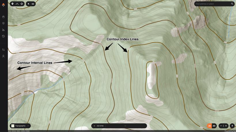
Every fifth line on a topographic map is darker in color and thicker. This is known as an index line. Index lines typically carry an elevation number, which is the elevation at that index line.
The fainter intermediate contour lines between index lines are not labeled but instead follow the contour interval. In the case of GOHUNT maps, these intervals appear every 40 feet, so every fainter line is 40 feet higher or lower than the one next to it.
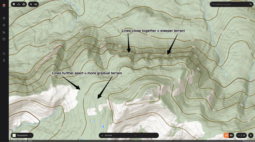
Contour lines get closer together in steep terrain and farther apart on flat terrain. This is important when looking for bench-type, flat features in the terrain.
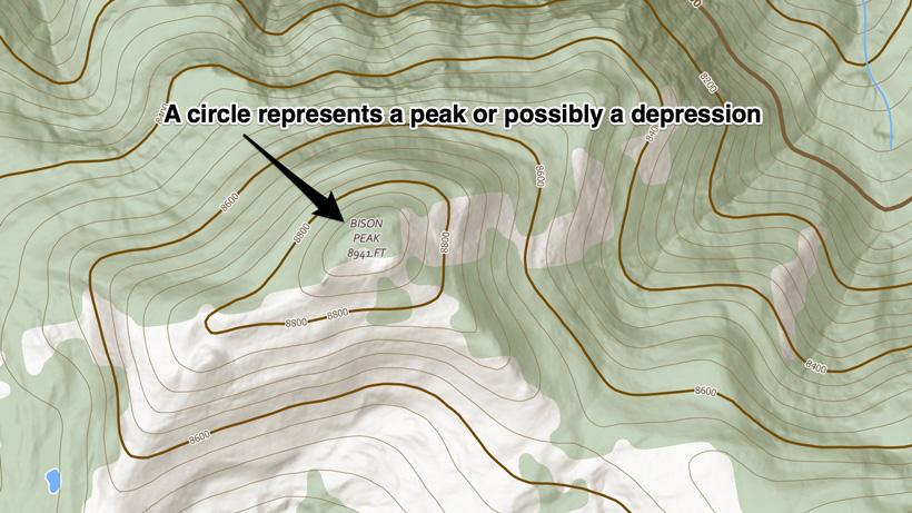
Contour lines that close or form circles represent a peak, mountain top or a depression.
Everything along a contour line is the same elevation, at least on the map. Theoretically, if you hiked along a contour line, you would never go up or down.
Look for V or U-shaped contour lines to spot a canyon or valley. The more like a V that the contour lines are, the steeper the walls, while a U-shaped formation has less steep sides. These formations usually have a creek or water sources flowing down them as well. The U or V will always point uphill.