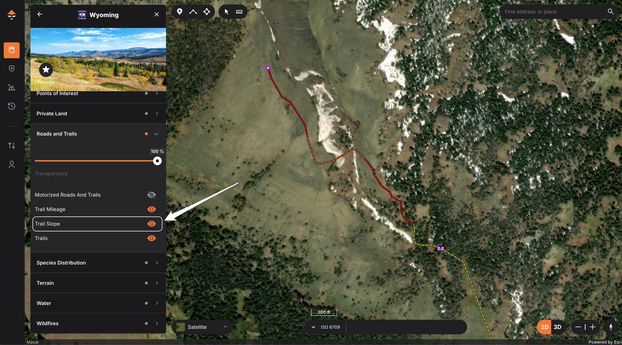


Trail Slope Layer on the web version of GOHUNT Maps.

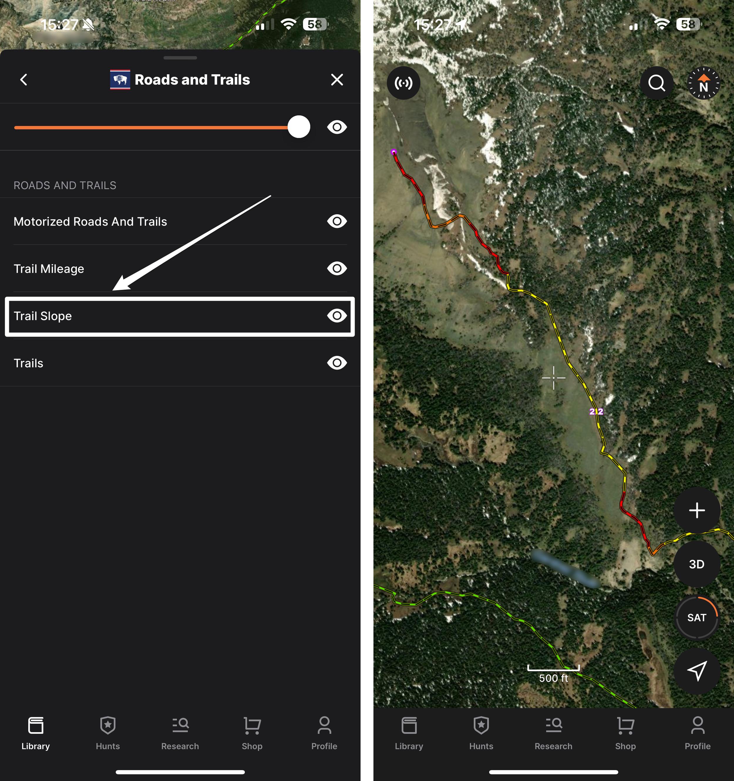
Trail Slope Layer on GOHUNT Maps mobile app.
For hunters, understanding the terrain is critical for both success and safety in the field. Whether you're navigating the backcountry in pursuit of elk, deer, or other game, having a clear sense of trail difficulty can make the difference between a productive hunt and a grueling day. GOHUNT’s latest app update introduces the Trail Slope Layer, a powerful tool specifically designed to help hunters evaluate terrain steepness at a glance, ensuring strategic and efficient planning for your hunt.
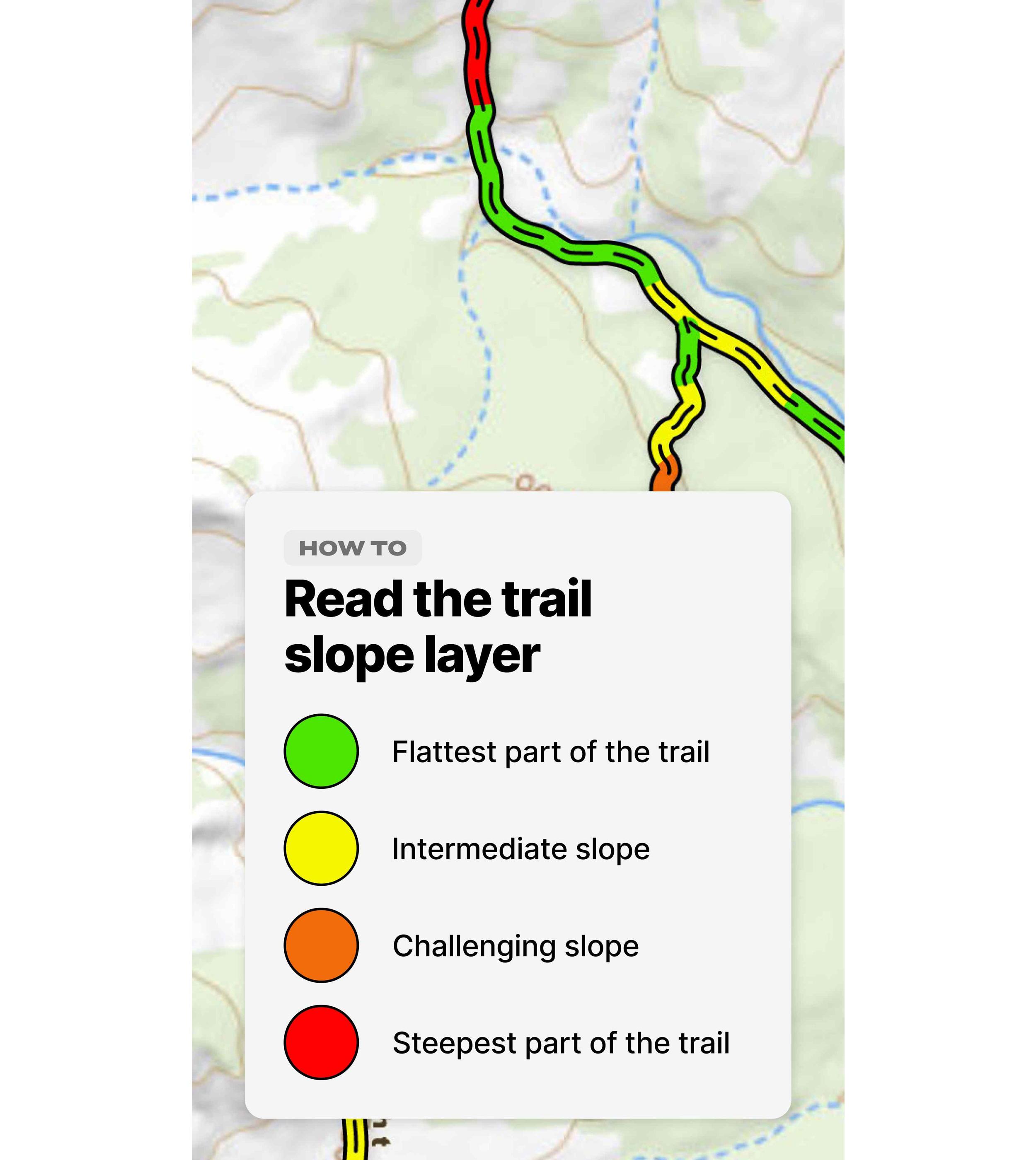
The Trail Slope Layer uses a simple, yet effective color-coded system to represent the steepness of the trail:
With this easy-to-understand visual guide, hunters can quickly assess the difficulty of different sections of the trail, helping them make informed decisions about the best routes to their target areas.
The Trail Slope Layer can be used on both the web version of GOHUNT Maps and on our mobile app.
In hunting, the element of surprise is a hunter's ally—but surprises in the terrain can be a significant setback. Steep, unanticipated ascents or treacherous descents can wear you out, delay your approach, or even force you to abandon your chosen route.
The Trail Slope Layer eliminates these unwanted surprises by offering a comprehensive look at the slope of the terrain before you set out. This foresight allows hunters to make calculated decisions about their routes, improving not just the success of the hunt but also ensuring that you stay safe while moving through the backcountry.
The GOHUNT Trail Slope Layer offers hunters an incredible level of insight and planning capability. Before the hunt even begins, you can strategize around the difficulty of the terrain, ensuring that you’re setting yourself up for the best hunt possible. Whether you’re chasing game across wide expanses or moving through dense mountain terrain, this layer helps you plan the most efficient and tactical routes to reach your hunting grounds.
Green: Marks the easiest, flattest trails. These will be your quickest routes into or through your hunting area.
Yellow: Denotes moderate slopes that require more effort but are still manageable for a day’s hunt.
Orange: Represents increasingly challenging terrain, and will be much slower to travel—perfect for hunters looking to reach less accessible areas.
Red: Indicates the steepest and most difficult sections—these are areas that require peak physical conditioning (especially if you’re carrying a heavy pack), but often result in less hunting pressure.