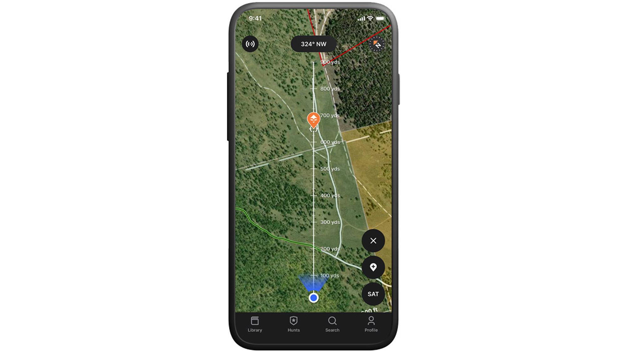


Screenshot example of the Rangefinder tool on our mobile app.
There are a few tools that will change the way you hunt, stalk animals, and even recover an animal after a successful hunt. And GOHUNT's Rangefinder tool on our mobile app is one of those features! At first glance, you might overlook this tool when you're in the field since you have a "rangefinder" already with you, but, that's not what this tool is used for and is much, much more than that...
If you're unfamiliar with GOHUNT Maps, learn more below:
Let's say you've glassed up an animal and want to put a stalk on it with your bow. Back in the day, you had to visually note where that animal was (either by memory or taking a photo), and by the time you hiked all the way over there, everything looked different, and you couldn't find the reference point of where that animal was.
Well... now you just need to range the animal with your rangefinder, and then using the Rangefinder tool on GOHUNT Maps, you can drop a waypoint exactly where you saw that animal. So now when you hike across a basin, you will know where that animal is, so you can use your mobile app to visually see where you are, in relation to where you marked the animal earlier. All that extra information using the Rangefinder Tool can greatly help you on the stalk to get in close for a shot!
You just shot an animal, and it's getting dark. The distance of the shot was 350 yards across a super steep canyon. You want to recover that animal that night, but by the time you get over there, it will be dark, which will make finding the animal tough in the steep terrain. There's got to be an easier way to recover your animal rather than walking over there and blindly walking up and down the steep terrain looking for your animal in the dark, right? Luckily, there is an easy way!
Now all you have to do is jump into the Rangefinder tool on the GOHUNT mobile app, enter the yardage of where you took the shot (or if you can see your animal, it is even better to re-range that animal), and then move your point your phone to the correct spot to mark exactly where your animal is. This will make your recovery very smooth without you having to grid the area in the dark.
I've used this exact method a bunch when recovering animals in the dark, and the Rangefinder tool has put me right on top of animals.
Similar situation to the archery example above. A rifle hunter can also use this tool. Once again, just range an animal with your rangefinder and then use the Rangefinder tool to drop a waypoint exactly where an animal is bedded. Then, before you make your approach, I like to take a line measurement from that waypoint to some feature on the map where I think I might be able to take a shot from. This is a great way to not waste a bunch of time once you hike over there and you realize that you hiked to the wrong spot and the distance is still too far to shoot. So I'll use the line tool to find a ridge or a terrain feature that looks like a good spot to take that animal and then measure out the distance to put myself in the best position for success. Note: this is when I like to switch to a topographical map, as I find that it is easier for my eyes to see ridgelines.
Overall, there are so many other great use cases for the Rangefinder tool. It's one of those features that I've been using a lot over the years, and I'm excited to have this feature rolled out to everyone using GOHUNT Maps.
If you have any questions, please don't hesitate to post them in the comments below, and I'll get back to you. Download the GOHUNT Maps mobile app today, and have your best season ever!
This article was originally published on August 10, 2022, and has been updated.
Open up GOHUNT on your phone
Tap the "+" icon
Select "Rangefinder"
Use your handheld rangefinder to range the spot
Zoom out on the phone so your range fits roughly into the yardage line
Point your phone at the target
Tap the waypoint icon and then enter in your yardage
Click "Mark Location"
And that's it!