

There are a variety of hunting opportunities throughout the western U.S., including guided hunts, semi-guided hunts, and landowner permits. However, the vast majority of hunters take to public lands every year in hopes of filling a tag and sharing the experience with friends and loved ones.
At GOHUNT, we create research and mapping tools to help hunters identify opportunities to get in the field – inclusive of every state, species, and weapon of choice. By using the GOHUNT App or “Filtering” feature on the website, you’re able to input all of those preferences – and more – and we’ll show all of the possible hunting units and seasons that meet your criteria.
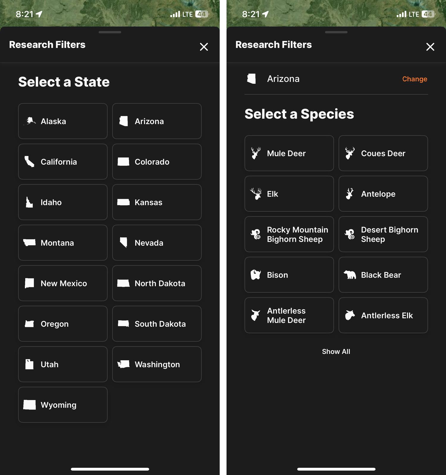
First, let’s jump into the GOHUNT app. You’ll see “Research” at the bottom. That is the entry point anytime you’re in search of unit-level information about hunts in the West.
From here, the GOHUNT app accepts inputs for number of bonus points, residency (resident or nonresident), draw odds (your odds of drawing, given number of points and residency), trophy potential and weapon type/season.
The percentage of public land in a unit dictates how much of the unit is readily accessible versus what is held privately; therefore, requiring permission to hunt. Hunters should use GOHUNT Maps to determine what public lands are in the unit (state, Forest Service, Bureau of Land management or other) as there may be other factors that impact the number of huntable acres.
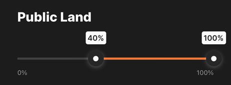
If you have a minimum threshold for public land percentage, move the slider on the right hand side under “Public Land” to that minimum percentage. When you’ve input all of the filters that meet your criteria for the state, species, seasons/weapons, etc. you can press “View # Results” and you will be taken to a list of all units that meet your criteria.
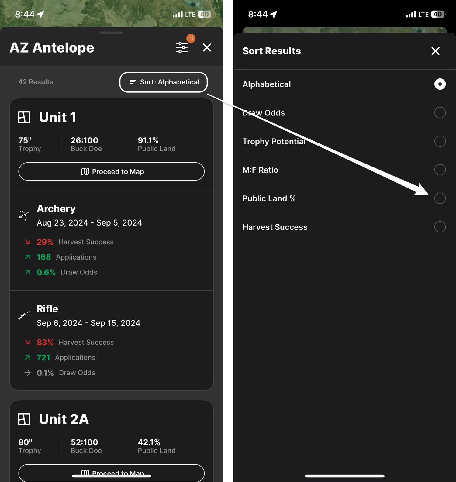
From here, you can sort all units by the percentage of public land in the unit, among other options.
The list of units is the starting point for narrowing down hunts you want to apply for (or buy tags for). There are advantages and disadvantages when hunting units with a high percentage of public land. The main advantage is accessibility to huntable land. A high percentage of public land generally means hunters have a variety of options to enter huntable areas and get away from other hunters. Generally, areas with more public land come with decreased odds of drawing the permit, especially if populations and trophy potential are promising for other hunters.
On the contrary, units with a low percentage of public land have their own advantages and disadvantages. Units with more private land can usually be easier to acquire tags in because of the increased difficulty to obtain access to huntable land. The public land in these units is often easily identified and can be overhunted. Hunters who aren’t afraid to put in the groundwork calling landowners or knocking on doors can use these areas to their advantage because most are unwilling to do the legwork getting access on private land.
Pro tip: Most states have programs in place to grant public access to privately held lands. These can be hidden gems for hunters to easily gain hunting access.
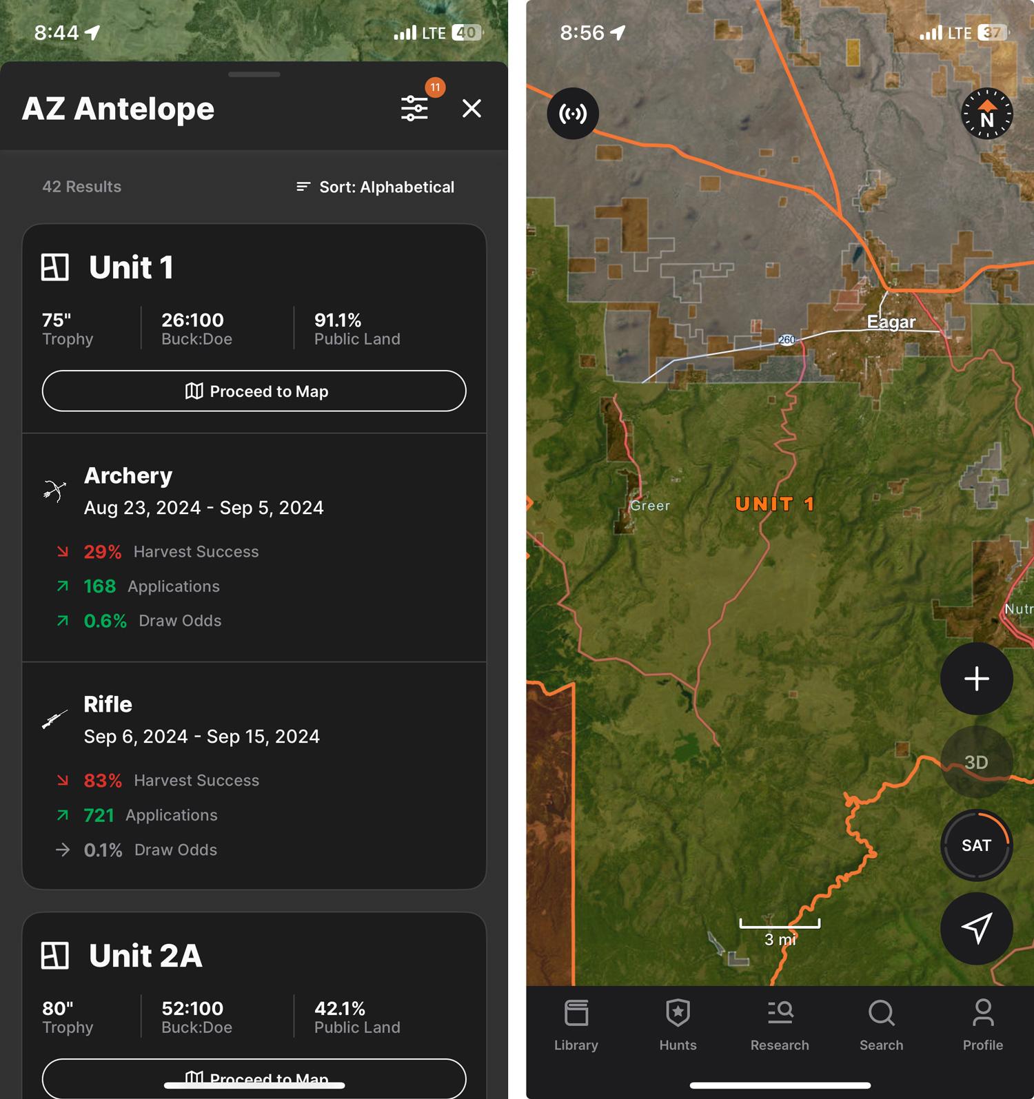
Once you’ve identified a unit of interest, tap “Proceed to Map” to be taken to that unit on the map. From here, add government/private land layers, motorized roads and trails, wildfires, walk-in access and other layers to get a complete picture of the unit.